


Getting accurate, up-to-date information is one of the most persistent challenges during a heavy rainfall event. Now, a group of researchers is looking to change that – transforming existing mobile networks into flood and storm sensors.
Featured researchers

Director, Global Big Data Technologies Centre

Deputy Head Of School (Teaching And Learning), Faculty of Engineering & Information Technology
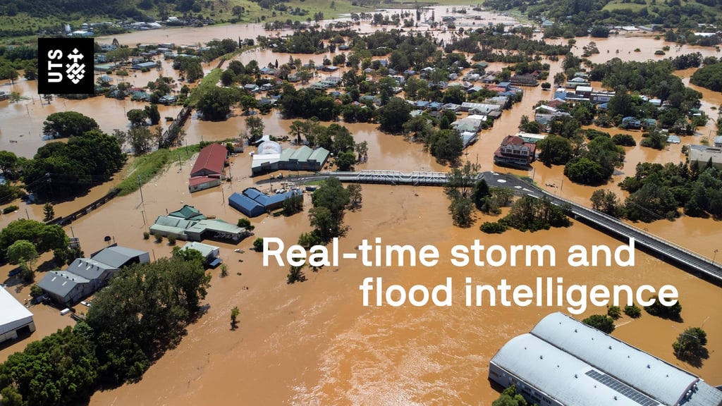
Lismore is Australia’s most flood-prone postcode.
Here, on Bundjalung country in NSW’s Northern Rivers, residents are prepared for rainfall and river rises. Most have lived through floods before. They take alerts seriously. With an eye on the forecast, they know how high the water needs to rise before it reaches their front steps.
But in February 2022, a catastrophic flood took many locals by surprise. More than 700mm of rain fell through the night, the sheer amount of it catching people off guard.
“It was monumental,” says Annie Kia, who lives in a small village 15km upstream. “The rainfall we had here was off the scale in terms of its intensity.”
By the time people realised the water would surpass the high-water mark of 1974, evacuation routes were already cut off.
“A lot of people nearly died around me,” says Kia.
Peaking at 14.4 metres, the flood soon became the town’s highest on record.
Only when the waters receded did the level of destruction reveal itself. People’s homes were uninhabitable, farmers lost entire herds.
“Their cattle were swept downstream,” says Kia. “Their tractors, all of their farm equipment. These are all things that could be saved if those people knew a flood of really huge dimensions was heading for them.”
32
lives lost in the February 2022 floods across South East Queensland and the NSW Northern Rivers.
$
6B
in insurance claims paid out from damages caused by east coast floods in 2022.
A world-first solution
“One of the issues with flooding that we have at the moment,” says David Monk, “is limited ability to have real-time data.”
As a chief superintendent with the NSW State Emergency Service (SES), Monk relies on data to make informed decisions during an emergency response.
But timely, accurate information can be hard to come by. Rainfall and river level gauges provide limited coverage. Area rain data and forecasts are too broad. Warnings and alerts sometimes lag hours behind the reality on the ground.
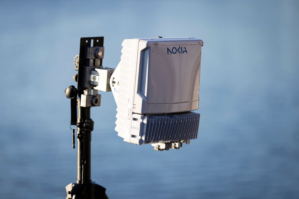
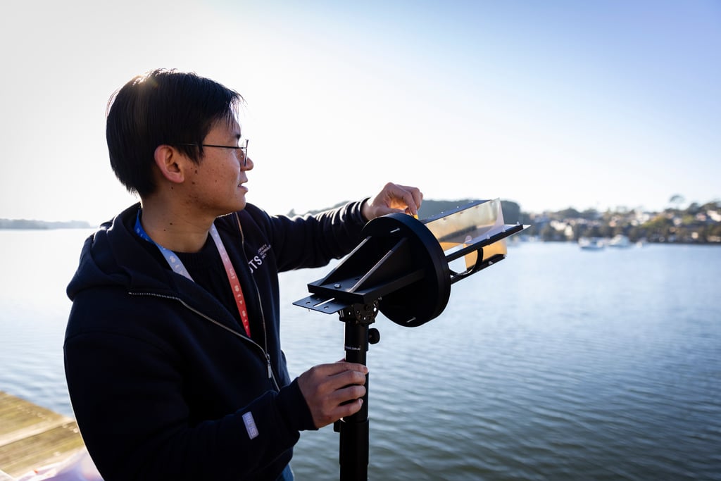
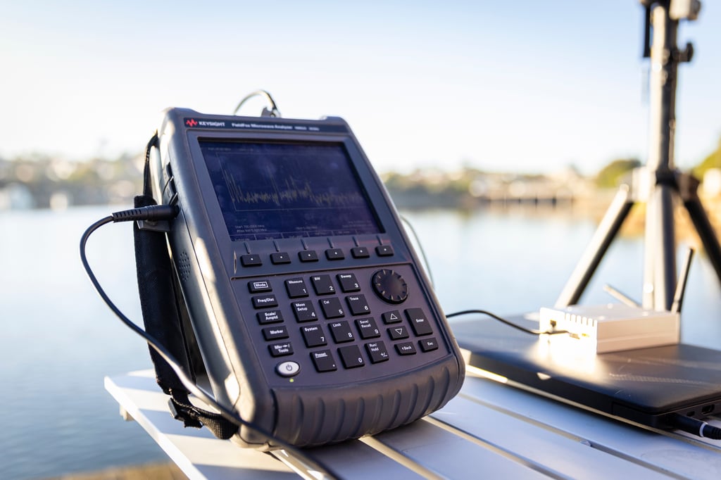
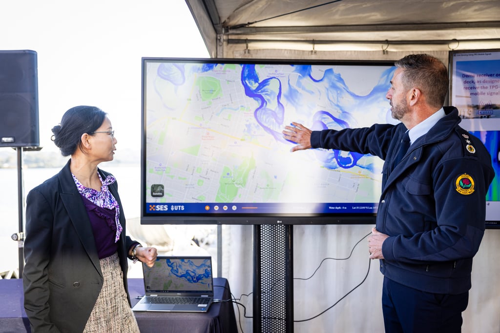
This is where Distinguished Professor Jay Guo is hoping to change things. His team of researchers from the TPG-UTS Network Sensing Lab has created what might be the world’s first real-time rainfall and water level sensing tool.
“With this technology,” he says, “the whole world will have a better tool to manage flooding risks.”

“This will absolutely save lives down the track.
This is a game changer.”
SES Commissioner Mike Wassing
How the tool works
The solution starts with radio signals. Specifically, the signals your mobile uses to connect to the network.
Because these signals are affected by the surrounding environment, they can tell us things about atmospheric conditions – like heavy rain – and nearby objects and surfaces – including bodies of water.
“By harvesting the information in the change of these water signals,” says Guo, “you can get the information, the intelligence, about water movement. Like flooding.”
It’s a method known as network sensing, and it’s as ingenious as it is effective.
By turning mobile networks into flood and storm sensors, it can show emergency services how quickly waters are rising, help them predict when a river might overflow and understand when a community is at risk.
We’ve proven that bouncing signals from mobile phone towers onto bodies of water can detect changes and this data when analysed and visualised using artificial intelligence can predict risks to infrastructure and communities.
Flood forecasting
The second part of the UTS research team’s solution uses the harvested information to perform flood modelling.
“Current government flood watch services are mostly based on traditional, conventional approaches,” says Associate Professor Wenjing Jia, “which are rather limited by their slow response time.”
While these systems can take hours to generate broad area warnings, the network sensing tool, she says, is capable of providing granular, localised forecasts within a matter of minutes.
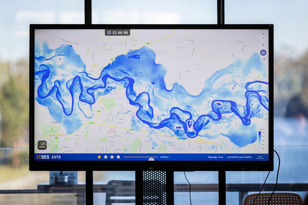
It does this by using machine learning first to interpret the signal data, then to create a digital twin.
The digital twin – essentially a three-dimensional model – shows streets, properties, waterways and elevations. Using the harvested rainfall and water level data, this model can visualise current conditions and simulate an unfolding flood event in the impacted area.
What this means is that emergency services can see exactly which streets and houses are likely to be inundated in the next ten minutes and next hour.
Making an impact
“This technology has the potential to provide the NSW SES with next-level capabilities,” says SES Commissioner Mike Wassing.
As a partner in the TPG-UTS Network Sensing Lab, the SES stands to be one of the main beneficiaries of this tool.
The speed of measurement and analysis has the potential to reduce their response times and allow them to issue rapid alerts. The localised nature of the information also means these alerts can be targeted.
And while the technology is still being tested, so far it’s proving effective. Trials along the Parramatta River in Sydney have achieved high levels of accuracy when measuring rainfall intensity and estimating water levels.
For the project’s other partner, TPG Telecom, the results are promising.
“We want to make a positive difference in the world,” says TPG’s Head of Wireless Strategy, Jeff Owens. “We see this as an exciting new technology that will transform our communications-oriented network into an integrated sensing and communications network.”
Increasing resilience
One of the features that makes network sensing so appealing is that it doesn’t depend on new infrastructure. As Guo puts it: “Nothing new needs to be built, no dedicated sensors.”
This means minimal costs for emergency services, for telecommunications operators and for network asset owners.
It also means the solution is broadly applicable, with opportunities to deploy it around the world.
“Flooding is not a local problem,” says Guo. “It’s a global problem.”
As far as his team is concerned, the network sensing tool is a low-cost solution that can be used anywhere there’s a mobile network.
For now, however, their focus is on the home front, planning pilot trials before they look to large-scale deployment across NSW.
In terms of the solution’s potential, Wassing is unequivocal. “It’s a game changer,” he says, “in terms of being able to sense rainfall and floods.”
With any luck, the tool will be operational in the not-too-distant future, providing authorities and communities with better flood predictions and more timely warnings.
Story
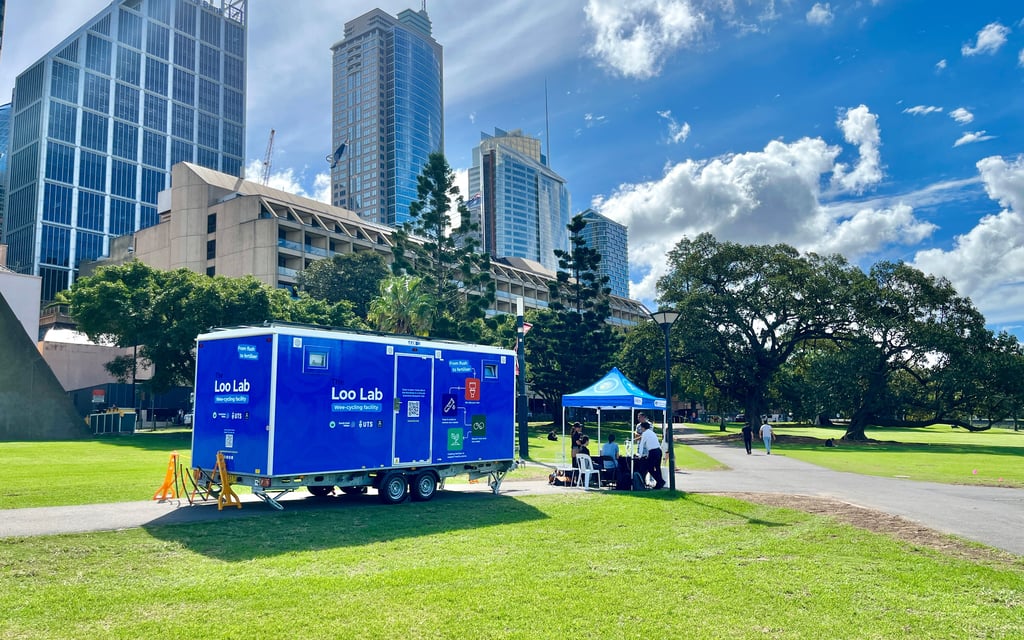
Liquid gold
The NiCE Loo uses advanced water filtration to turn urine waste into valuable fertiliser and help our sewerage system work more efficiently.

Story
AI and machine learning take a quantum leap
The hardware side of quantum computers often gets the attention, but researchers are working on the programs and algorithms that will power these machines –...
Story
Not just a pipe dream
How AI, data science and robotics are helping protect Sydney’s water supply.

Story
Liquid gold
The NiCE Loo uses advanced water filtration to turn urine waste into valuable fertiliser and help our sewerage system work more efficiently.
Story
AI and machine learning take a quantum leap
The hardware side of quantum computers often gets the attention, but researchers are working on the programs and algorithms that will power these machines –...
Story
Not just a pipe dream
How AI, data science and robotics are helping protect Sydney’s water supply.