

- Posted on 17 Jan 2021
- Updated on 17 Jan 2021
- 3-minute read
Capturing the flow of food to ensure Sydney's food production is resilient and secure into the future.
RESEARCH OUTPUTS
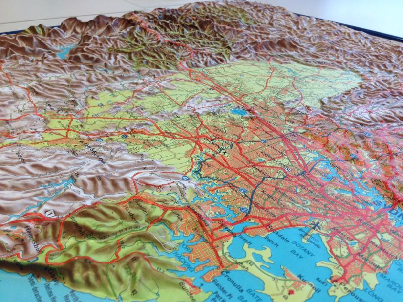
In order to understand how Sydney feeds itself, both now and into the future, we are investigating the Sydney Basin’s capacity to produce food – and to understand the factors that threaten to reduce this ability. Sydney’s Food Futures (2015-2016) is a collaborative research project being undertaken by ISF, in conjunction with a number of government and industry partners.
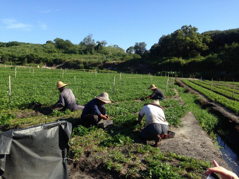
Australia’s food supply chains are increasingly vulnerable to shocks and trends related to the impacts of a changing climate. With Sydney’s population of 4.2 million expected to grow by 1.6 million people in the next 20 years, local food production is further threatened by the need to house – and provide infrastructure for – a growing population.
The food security of the Sydney Basin is under threat due to increasing reliance on distant production, distribution and transport systems, and increasing competition for land for housing in peri-urban areas. Few studies have been conducted about how Sydney will feed itself into the future – and what changes are needed to ensure Sydney remains food secure in decades to come.
A ‘foodsheds’ approach can inform an integrated, smart response that will ultimately ensure Sydney is food secure and that farmer livelihoods and fertile soils are protected, while providing housing, jobs and mobility for a growing Sydney. Inspiration for this approach came from the U.S-based Foodprints & Foodsheds Project. The Victorian Eco-innovation Lab in conjunction with partners has also initiated a Foodprint Melbourne project.
The goal of the Mapping Sydney’s Foodsheds project is to increase the resilience of Sydney’s food system to both global and local challenges.
Project objectives are to:
- develop, apply and map Sydney’s current and future foodsheds
- identify and evaluate feasibility and desirability of potential future foodsheds in Sydney Basin through local stakeholder engagement
- create an evidence base to support councils, and state and federal governments in their decision-making to stimulate and support agricultural productivity in the Sydney Basin
- increase the food literacy of consumers, related to farming, supply chain and health.
Our food system is made up of a number of complex stages and interactions, from farms and laboratories to storage and transportation, processing plants, markets, supermarkets, and finally, consumers. Mapping our food production is a way of capturing the flow of food within this system, and by mapping various scenarios for future change, we can begin to understand where the system’s vulnerabilities lie.
This project has developed mapping to indicate where Sydney’s current and potential food producing areas are located. A range of scenarios were modelled and mapped to indicate how different situations – climate shocks, changes in diet and population growth, for example – will affect Sydney’s food security. You can see the interactive maps here.
Sydney food futures (Website)
Researchers


- Laura Wynne
- Steve Mohr
- Kristian Maras
PROJECT | 2014
Food for thought
The world was slow to recognise Australian warnings about phosphorous scarcity and the threat to global food security. But now countries are turning to ISF for advice on phosphorous sustainability.
SDGs

This project is working towards UN Sustainable Development Goal 12.
Explore Landscapes and ecosystems
Climate adaptation; Food systems; Institute for Sustainable Futures; Landscapes and ecosystems
Research Centre
Years
- 2014-2016
Location
- Sydney
Services and capabilities
Client
- Wollondilly Shire Council